

Upper Rio Grande Colorado: Year-Round Adventures Near Lake City

Upper Rio Grande Colorado: Year-Round Adventures Near Lake City
Updated May 13, 2026
IIf you have ever wanted to stand at the headwaters of one of North America’s great rivers, watch a bull moose graze in an unspoiled valley, cast a line into Gold Medal water, or drive a road that started life as a stagecoach route, the Upper Rio Grande Colorado backcountry is your place. And it is closer than you think. Less than half an hour from downtown Lake City, the Upper Rio Grande Colorado corridor opens up into a vast stretch of untouched wilderness, alpine lakes, and high peaks that visitors quietly call one of the most beautiful corners of the state.
This guide will walk through where the Upper Rio Grande actually is, how to get there, what to do across all four seasons, where to sleep, and the local know-how that turns a good trip into a great one.
Where exactly is the Upper Rio Grande Colorado region?
The Upper Rio Grande is the high-mountain country where the Rio Grande River begins its 1,900-mile journey to the Gulf of Mexico. The headwaters rise in the San Juan Mountains of southwest Colorado near the Continental Divide, then run east through Hinsdale and Mineral counties before turning south into New Mexico.

Topographic map of the Upper Rio Grande area in Hinsdale County, just south of Lake City. Click to enlarge.
For visitors, “the Upper Rio Grande” usually refers to the corridor along Forest Service Road 520 (locally known as Rio Grande Reservoir Road), which leaves the Silver Thread Scenic Byway and climbs up toward the Rio Grande Reservoir, the Weminuche Wilderness boundary, and historic Stony Pass. From Lake City, you reach the area by heading south on Highway 149 toward Creede, then turning west onto Forest Service Road (FSR) 520. From Creede, the turnoff is roughly 18 miles upriver. The first 19 miles of FSR 520 are easily accessible by 2-wheel-drive vehicles up to Lost Trail Station. Beyond that, you will need a four-wheel-drive vehicle to take the rest of the road through Timber Hill, over Stony Pass, and down into Silverton.
A road with history under your tires
Rio Grande Reservoir Road did not start out as a recreation route. It was an old stage and freight road, built to move silver ore, supplies, and hardy travelers into the mining camps around Silverton over Stony Pass. Today, the first 19 miles or so are well-graded gravel and dirt that most 2-wheel-drive cars can handle in dry conditions. Past that, the road climbs Timber Hill and tops out over Stony Pass at more than 12,500 feet before dropping into Silverton, and a high-clearance 4WD vehicle is required for the upper section.
The rich history of this area is documented on a series of twelve roadside interpretive signs along the old stage route now known as Forest Service Road 520, from Freemons to Grassy Hill on to Stony pass. Follow the adventures and hardships of early-day travelers and miners, challenges of fisheries and ranches.

One of twelve roadside interpretive signs located along Forest Service Road 520.
What makes the Upper Rio Grande Colorado special
A few things set the Upper Rio Grande apart from Colorado’s better-known mountain destinations.
The southern border is the Weminuche Wilderness, the largest designated wilderness area in Colorado at nearly half a million acres. Trailheads off FSR 520 lead straight into it, with no shuttle, no permit lottery, and no entrance booth. To the north is the Rio Grande National Forest, spanning over 1.8 million acres, also with many accessible trails.
The Rio Grande River along this stretch carries one of the longest sections of Gold Medal trout water in Colorado, with more than 80 lakes and reservoirs and 150 streams in the broader Upper Rio Grande area. Anglers come from across the country to fish here.
The wildlife is as wild as the country. Moose, elk, mule deer, black bears, mountain lions, bighorn sheep, and the occasional river otter all live in this watershed. Early mornings and dusk in the willow flats around the Rio Grande Reservoir can feel like a nature documentary.
And the scenery shifts dramatically with the seasons, which is why this guide is written for all four.
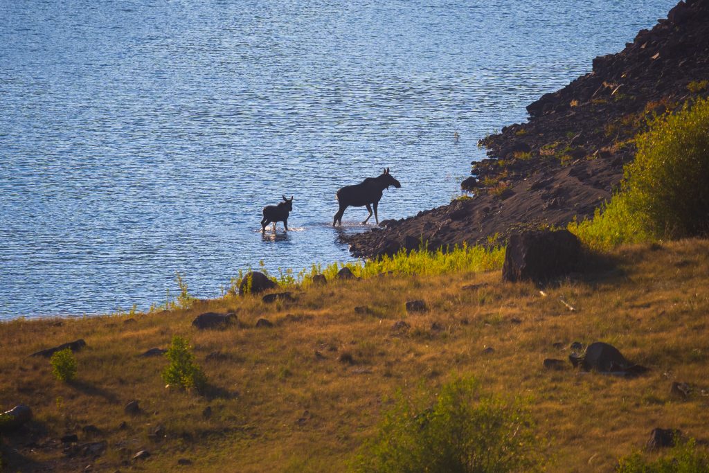
A moose and her calf in the Upper Rio Grande Reservoir.
Summer in the Upper Rio Grande Colorado: the high season
Summer is the busiest and easiest time to visit the Upper Rio Grande, and for good reason. Snow is finally off the high passes, wildflowers carpet the basins, and the days stretch long and bright.
Hiking is the headline activity. Trailheads spread along FSR 520 reach into the Weminuche Wilderness and the Rio Grande National Forest in every direction. A few of the most popular routes:
Weminuche Wilderness
- Weminuche Trail #818 (Thirty Mile Campground, ~12 mi in on FSR 520): 5.5 miles one way, moderate. Climbs through aspen and spruce to Weminuche Pass at 10,600 feet. Foot and horseback only.
- Grizzly Creek Trail #814 (Thirty Mile Campground, ~12 mi in): 9.7 miles one way, difficult. Pushes up to the Continental Divide National Scenic Trail. Foot and horseback only.
- Grizzly Lake Trail #890 (junction 6.5 mi up Grizzly Creek Trail): 3.8 miles one way, moderate-difficult. About 1,500 feet of gain over six switchbacks to a high alpine lake; ends at the Continental Divide Trail.
- Ute Creek Trail #819 (~16 mi in on FSR 520, above the reservoir inlet): 13.2 miles one way, moderate. Climbs past Black Lake (10,900 ft) to a Continental Divide Trail junction at 11,500 ft.
- Ute Lake Trail #905 (junction with Ute Creek Trail, ~10 mi in): 3 miles one way. Branches off Ute Creek Trail and ends at the Continental Divide Trail near Ute Lake.
Rio Grande National Forest
- Lost Trail Creek Trail #821 (~18 mi in on FSR 520): 11 miles one way, moderate. Parallels Lost Trail Creek toward Carson Pass through aspen groves and old mining country. ATVs under 50″ allowed. Please respect no-trespassing signs on the historic mining inholdings.
- West Lost Trail #822 (spur off Lost Trail Creek Trail): 7.5 miles, moderate-difficult. Connects to the Continental Divide Trail; pairs with #821 for a ~20-mile loop. Open to hiking, biking, and horseback.
- Heart Lake Trail #823 (spur off Lost Trail Creek Trail): 1.8 miles one way, moderate-difficult. Non-motorized route to Heart Lake.
- Pole Creek Trail #820 (~26 mi in on FSR 520): 4 miles one way, moderate-difficult. Parallels Pole Creek and connects to the Continental Divide Trail.
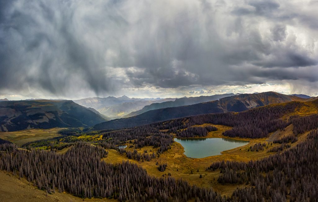
Afternoon thunderstorms rolling into the Upper Rio Grande area.
Backpackers chase bigger multi-night objectives out here too, including the Rio Grande Pyramid, The Window, and Tabeguache Pass.
Fishing in summer is exactly what its reputation suggests. The Rio Grande Reservoir, about 12 miles along FSR 520, holds rainbow, brook, and cutthroat trout, and the river above and below the dam runs cold and clear. Wakeless boating, kayaking, and paddleboarding are all welcome on the reservoir. Drop a line from the bank at the boat ramp, or near Thirty Mile or River Hill, or float the river with a fly rod in hand. A valid Colorado fishing license is required for anyone 16 and older to fish at the Rio Grande Reservoir, available through Colorado Parks and Wildlife.
Road Canyon Reservoir, about six miles along FSR 520, at over 9,200 feet in elevation, is a 152-acre, productive trout fishery managed as a Colorado State Wildlife Area. It offers year-round access for wakeless boating and fishing for rainbow and brook trout. The area features a nearby 6-unit campground and is known for scenic, high-altitude views. A valid hunting or fishing license or pass is required for everyone 16 or older, and visitors should check current hunting, fishing and land use regulations when planning to visit a State Wildlife Area.
Scenic driving is its own activity. The lower part of FSR 520 makes a beautiful afternoon out and back from Lake City or Creede, and the upper section over Stony Pass is on every Colorado 4WD enthusiast’s bucket list. Bring a paper map, plenty of water, and a full tank of gas. There is no fuel past Creede.
A few summer cautions worth taking seriously: afternoon thunderstorms build fast above treeline, so start early and aim to be off ridgelines by 1 p.m. Creek crossings in June and early July can run dangerously high during peak snowmelt. And there is no cell service above the reservoir dam, so let someone know your plan before you go.
Fall (September through October): the golden window
Locals will tell you in confidence that fall might be the best season of the year. The aspen groves along the Rio Grande and up the side drainages turn brilliant gold, the crowds thin out as kids head back to school, the insects are gone, and the elk start to bugle.
Fishing stays excellent through September and into October. Brown trout get aggressive in the pre-spawn, and the river is often at its most photogenic with low, clear water and golden reflections. Hiking stays open at lower elevations even after the first dustings of snow appear on the high peaks. The drive itself becomes a destination, with stretches of FSR 520 lined in aspens that look almost backlit on a sunny afternoon.
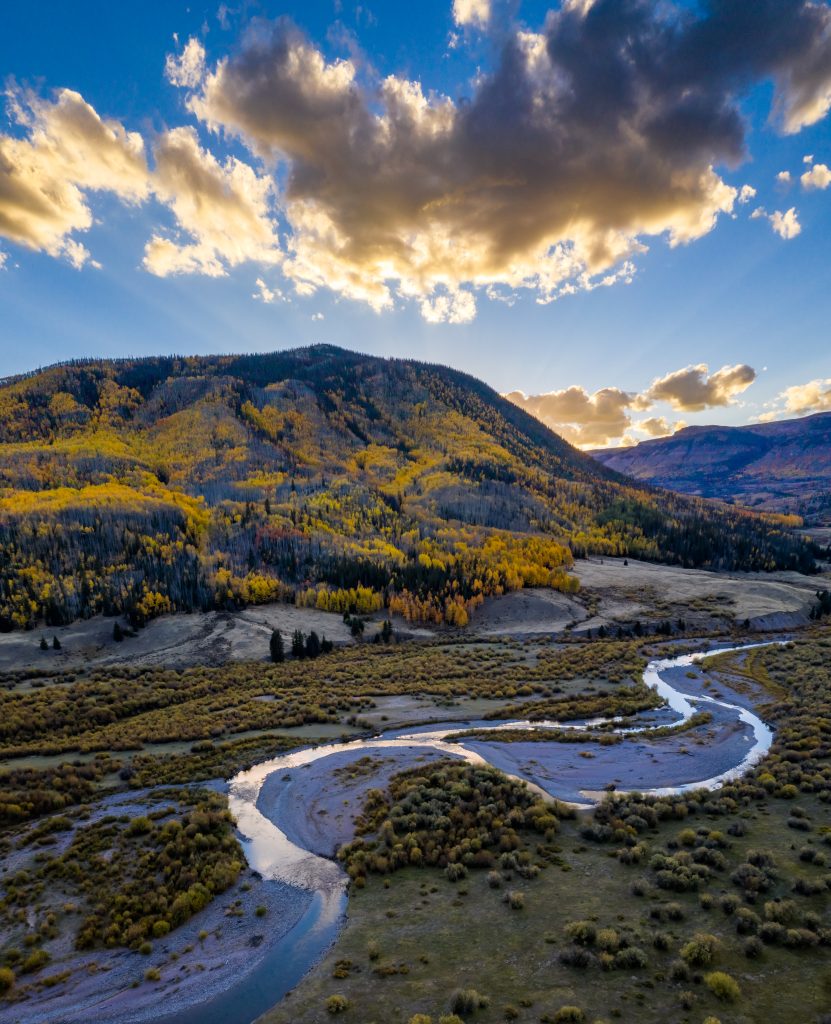
Fall colors along the Rio Grande.
Fall is also hunting season across the area. If you are not hunting, plan to wear blaze orange anyway when hiking off-trail in October, and check Colorado Parks and Wildlife dates before you go. Hunters traveling to camp will find more solitude in this corner of the state than in many of Colorado’s better-known units. Colorado Game Management Unit 76 is a premier, high-altitude, draw-only unit in the southern San Juan Mountains near Creede, encompassing the Upper Rio Grande area, known for trophy elk hunting and limited licenses. This unit consists of roughly 1,100 square miles, with 95% public land, including parts of the Rio Grande National Forest and Weminuche and La Garita Wilderness areas.
Keep an eye on the weather forecast, carry chains or traction tires, and be ready to turn around if conditions change.
Winter (November through March): the quiet season
When the snow comes in, the Upper Rio Grande gets very quiet, and very beautiful. Most of the campgrounds, cabin operators, and resorts shut down for the season. What is left is a hushed, snowbound landscape that rewards anyone willing to come prepared. Although the road is not officially closed, neither is it plowed past the Road Canyon Reservoir.
Snowmobiling is the most popular winter activity in the area, taking care not to venture into the Wilderness, just across the frozen Rio Grande. Many of the same routes that carry Jeep traffic in summer become snowmobile highways once the snow piles up.
Cross-country skiing and snowshoeing offer a quieter alternative. The National Forest side of FSR 520 can make a peaceful tour through snow-laden spruce. Ice fishing on the Rio Grande Reservoir is possible once the ice is reliably thick, and Road Canyon Reservoir is a highly popular ice-fishing spot. Always check ice conditions first, since high-elevation reservoirs can have variable ice. The Rio Grande County Tourism office is a good local source of conditions.
On clear, cold-snap mornings you may glimpse a few experienced wild ice skaters gliding across the Rio Grande Reservoir, an activity that has grown easier to reach now that the Forest Service keeps FSR 520 open all winter. It is a beautiful sight, and a serious risk: backcountry reservoir ice can change overnight and break without warning, and the small community that does this travels with rescue gear and a partner. Admire from the shore.
Wildlife viewing in winter takes patience but pays off. Bald eagles winter in the river corridor, and moose are easier to spot against the snow. Sunrise on a clear, cold winter morning along the Rio Grande is one of those memories that stays.
If you have not driven a Colorado mountain road in winter before, do not start here. The closest plowed roads are on the Silver Thread Scenic Byway. Park there and travel into the upper country by snowmobile, ski, or snowshoe with the right gear and a partner.
Spring (April through May): the shoulder season
Spring in the Upper Rio Grande is a study in patience. The valley floor will start to green up in April, but the high country can stay buried in snow well into June. Roads reopen in stages as the snow melts. Lower FSR 520 typically clears earlier, while Stony Pass and the upper road can stay closed into summer. Always check current Forest Service conditions before you head out. FSR 520 is generally closed from March 15 to May 15.
What spring offers, for the visitor who likes a quieter experience, is wildlife. Moose calves and elk calves appear in May. Birds return to the willow flats. The river roars with snowmelt, which is striking to watch from a safe overlook but dangerous to wade. Fishing can be slower as the river runs high and cold, but a few warm afternoons can produce surprisingly good days for anglers who know how to read off-color water.
Where to stay in the Upper Rio Grande Colorado
The Upper Rio Grande corridor offers everything from primitive Forest Service campgrounds to historic ranch cabins. Reservation policies vary by site, so plan ahead.
Forest Service campgrounds along FSR 520:
- Thirty Mile Campground: 35 sites at ~9,000 ft. Open Memorial Day through Labor Day. Reservation only via Recreation.gov. Potable water, vault toilets, fire rings, camp host, amphitheater. ~$29/night nonelectric, $58/night electric, plus a $2 weekend and holiday surcharge.
- River Hill Campground: 20 sites at ~9,250 ft. Open Friday before Memorial Day through the second Monday in September. Reservation only via Recreation.gov, up to 6 months ahead. Drinking water, vault toilets, some electric hookups, primitive boat ramp. Same pricing as Thirty Mile.
- Road Canyon Campground: Forest Service campground along FSR 520, accessible by 2WD. Check Recreation.gov or the Rio Grande National Forest for current dates and amenities.
- Lost Trail Campground: 7 first-come, first-served sites along Lost Trail Creek, ~1 mile from the upper end of the reservoir. Free. Vault toilet, picnic tables, fire rings. No drinking water (well closed); pack it in, pack it out.
Private cabin operations along the road are wonderful for first-time visitors who want a roof, a kitchen, and a view:
- Freemon’s Guest Ranch (~18 mi west of Creede): 15 historic cabins, a general store, a restaurant, and daily horseback rides.
- San Juan Ranch (~21 mi west of Creede): 30 cabins ranging from one to four bedrooms in a peak-rimmed valley; fishing, hiking, backpacking, and seasonal hunting.
- Little Squaw Resort (~30 mi west of Creede): small collection of CCC-built cabins at the confluence of the Rio Grande and Grizzly Creek, originally built for the workers who built the Rio Grande Reservoir.
- Thirty Mile Resort (~30 mi west of Creede): primitive private cabins on the edge of the Weminuche Wilderness, rented by the week from June 1 through September 30.
- Cabins at Lost Trail (18100 FSR 520, ~35 mi west of Creede): 6 fully furnished off-grid cabins at the base of Pole Creek Mountain, spaced for privacy.
- Lost Trail Station (~36 mi west of Creede): 2 modern off-grid summer cabins on a historic stage-route property along the Rio Grande.
Most cabin operators book up early for summer and fall. Reach out directly for rates and openings.
Practical tips for first-timers
A few things that locals know that the trail signs do not tell you.
Cell service ends above the Rio Grande Reservoir dam. Download your maps before you leave town, and tell someone where you are going and when you plan to be back.
Altitude is real. The reservoir sits at about 9,500 feet, and trailheads climb from there. Drink more water than you think you need, take it slow on day one, and pay attention to headaches or nausea.
Weather changes fast. Pack layers, a rain shell, and warm gloves any time of year. Snow is possible every month.
Leave no trace, please. This corridor stays beautiful because visitors carry out what they carry in. Pack out trash, use a stove instead of building new fire rings, give moose a wide berth, and keep dogs leashed near wildlife and water.
Fuel up in Lake City or Creede. There is no gas, no convenience store, and no quick fix past the FSR 520 turnoff. Fill the tank before you head west.
Buy your fishing license before you go. Colorado Parks and Wildlife sells licenses online and at retailers in both towns.
Respect private property along the corridor. Most of the land is national forest, but a handful of inholdings and ranch operations are private.
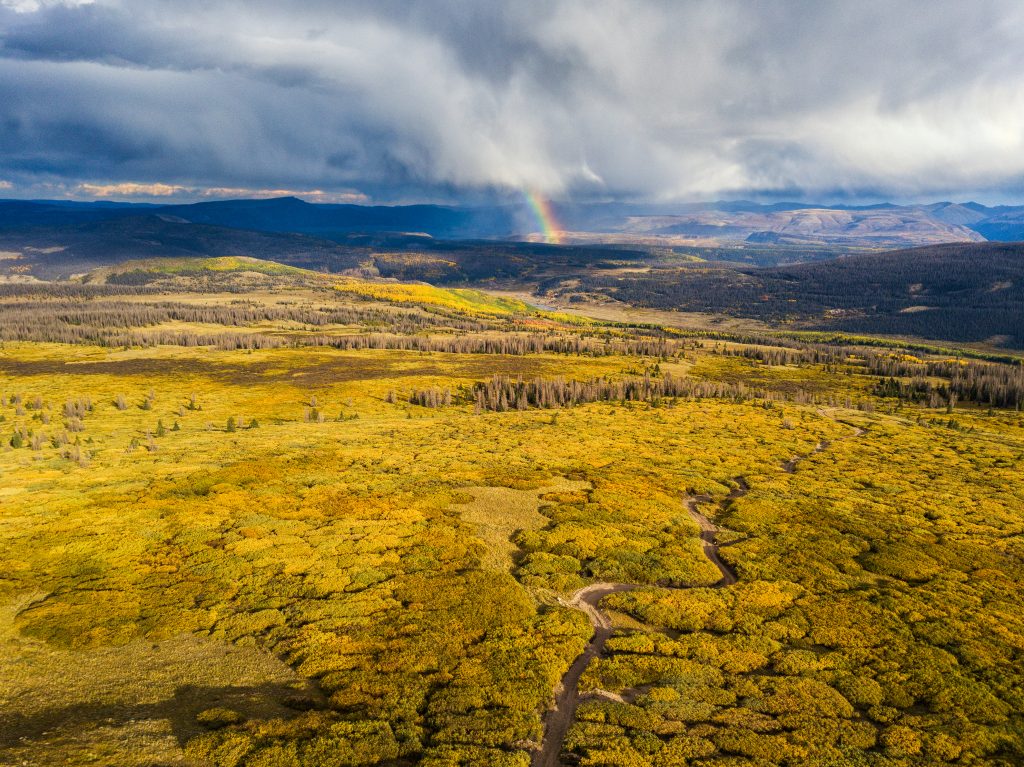
The sky, putting on a show in the Upper Rio Grande area.
Plan your Upper Rio Grande Colorado trip
The Upper Rio Grande is the kind of place that turns first-time visitors into return visitors. It is enormous, varied, and quietly grand, and it sits within easy reach of a small mountain town that knows how to welcome you.
For trail maps, lodging contacts, seasonal road updates, fishing reports, and event schedules, the Lake City Visitor Guide is the best starting point. The Lake City visitor center can also point you to local outfitters, guides, and gear shops.
If you would like a deeper dive into the corridor itself, the lakecity.com pages on Rio Grande Reservoir Road and Stony Pass and 4 Must-Do Adventures in the Upper Rio Grande are worth a read before you go.
We will see you out there.