
Driving the Alpine Loop: Mile-by-Mile Guide from Lake City
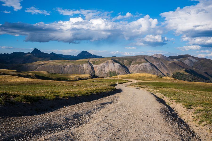
Above Treeline on the Alpine Loop, Photo: Michael Underwood

View Alpine Loop Status, multi-county regulations, travel information, and more at AlpineLoop.info.
There is no drive in Colorado quite like the Alpine Loop. It climbs above 12,000 feet, threads through old mining ghost towns, and connects three of the state’s most beloved mountain towns. From its eastern anchor in Lake City, the Alpine Loop Backcountry Byway invites you to slow down, look up, and step into a landscape that has been shaping travelers for more than a century.
This guide pulls together everything you need to plan the trip: the routes, the history, the vehicle options, the rules of the road, and a turn-by-turn rundown of the must-see stops along the way. Lake City is proud to be one of the gateways to this place, and we want your visit to feel like the peak experience it is meant to be.
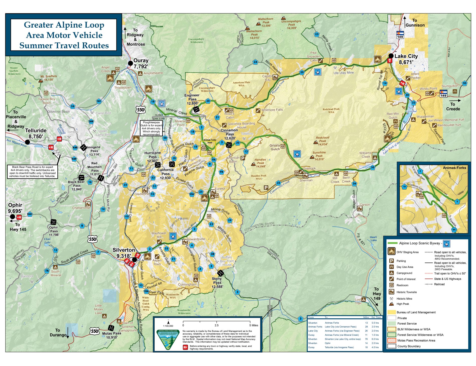
Map of the Alpine Loop, Click to enlarge
What Is the Alpine Loop?
The Alpine Loop Backcountry Byway is a 60-plus-mile network of old four-wheel-drive mining roads connecting the southern Colorado towns of Lake City, Silverton, and Ouray. It is one of only a handful of routes in the country designated as a Backcountry Byway by the Bureau of Land Management. This is not a paved scenic highway. It is a working network of high-elevation dirt roads that trace the same ground prospectors and pack mules crossed in the 1870s and 1880s.
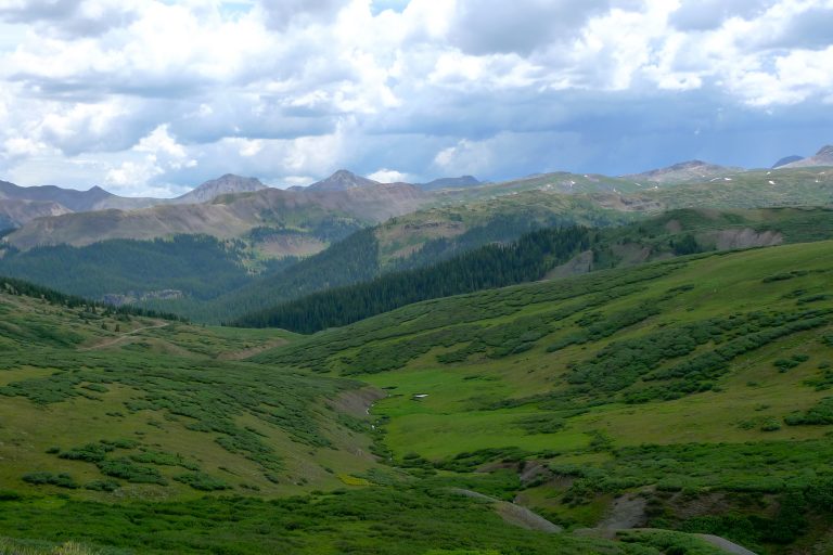
The Loop earns its name by climbing over two of Colorado’s most iconic mountain passes: Cinnamon Pass at 12,600 feet, and Engineer Pass at 12,800 feet. Much of the road sits above tree line, where the air thins, the wildflowers stretch to the horizon in midsummer, and the views simply do not stop. You will pass alpine lakes, abandoned mining cabins, restored ghost towns, and basins that will take your breath away.
For travelers based in Lake City, the Alpine Loop is one of the top attractions. It’s the reason many people make the drive into Hinsdale County, and once you have seen it, you understand why visitors keep coming back.
The Two Passes That Define the Loop
The Alpine Loop is built around two summits, and each one has its own personality.
Cinnamon Pass
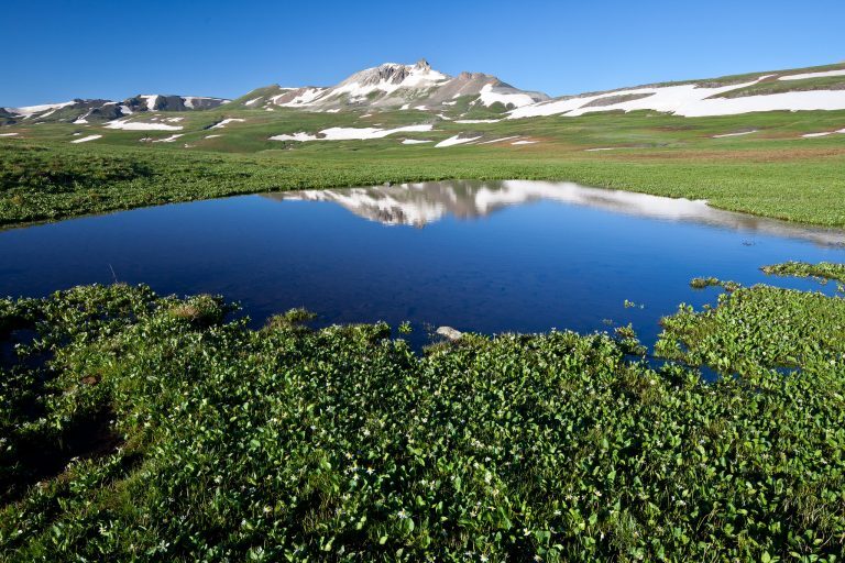
Cinnamon Pass tops out at 12,600 feet, and you will know the moment you arrive. The summit is often dusted with snow even in July, which makes for a memorable photo and a cool break from a sunny climb. From the top, the views drop away in every direction, with rugged peaks ringing the horizon and wildflower-streaked basins below.
About a mile east of the Cinnamon Pass summit, you will find American Basin, one of the most photographed places in all of Colorado. In July, the basin erupts into a wildflower display that draws photographers from around the country. Columbines, Indian paintbrush, larkspur, and dozens of other species blanket the meadows.
Engineer Pass
Engineer Pass climbs even higher, topping out at 12,800 feet. Much of the Loop above 11,000 feet sits along Engineer’s flanks, and most of that road runs above the tree line. The views are immense and uninterrupted.
The road up Engineer Pass is the most technical stretch of the entire Alpine Loop. The switchbacks on the western side, between Animas Forks and the summit, are narrow, rocky, and exposed. Climbing them is a significant accomplishment for any driver. Coming down them, especially in an unfamiliar vehicle, can be intimidating. How you approach Engineer Pass shapes the whole day, which is why we recommend driving the Loop clockwise from Lake City.

Engineer Pass, Photo: Michael Underwood
Pick Your Adventure: How to Experience the Alpine Loop
One of the best things about the Alpine Loop is that there is more than one way to do it.
The Full Loop in a 4WD Vehicle
To traverse the entire Alpine Loop, including both Engineer Pass and Cinnamon Pass, you will need a four-wheel-drive vehicle with high clearance. Stock SUVs with low-range gearing can do it. Jeeps, side-by-sides, and built rigs handle it comfortably. Drivers without high-clearance four-wheel drive should not attempt the pass roads.
Plan for a full day. Most travelers take six to eight hours to complete the Loop with stops, although you can stretch it longer if you want to soak in the sites, hike a trail, or have lunch in Silverton or Ouray.

Jeep Driving on the Alpine Loop, Photo: Michael Underwood
The Two-Wheel-Drive Portion
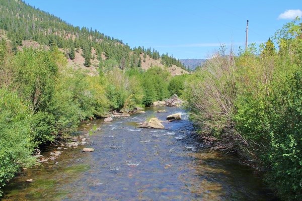
If you are visiting in a regular passenger car, you can still experience the Loop. County Road 30 is the part of the Alpine Loop that is accessible to a regular two-wheel-drive vehicle, and it is a beautiful drive in its own right. The route follows the Lake Fork of the Gunnison River and offers ample fishing along the river and at Lake San Cristobal, the second-largest natural lake in Colorado. From Lake City, you can drive the Engineer Pass side as far as Capitol City, and the Cinnamon Pass side as far as the American Basin. From Silverton, you can reach the Animas Forks ghost town. These are rough, unpaved drives, but they are doable in most passenger cars if you take it slow.

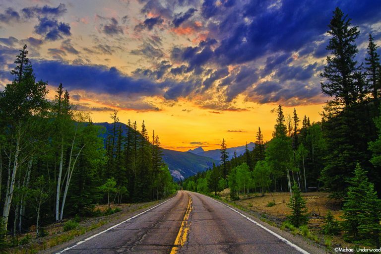
Sunset on the Alpine Loop
The OHV and ATV Experience
For many visitors, an off-highway vehicle is the most exciting way to experience the Alpine Loop. Lake City has several outfitters who rent OHVs for the day, and the local rules allow you to drive them right out of town and onto the Loop.
OHV Rules and Regulations
If you are bringing or renting an OHV, please read this section carefully. Lake City and Hinsdale County have a thoughtful set of rules designed to keep both visitors and the landscape safe. Knowing them in advance makes your day smoother and protects ongoing use of OHVs on the Loop.
All OHV use on Lake City and Hinsdale County roads must comply with Colorado state statutes pertaining to motor vehicles, and you must follow posted speed limits.
Hours of Operation: OHVs may operate from 6:00 a.m. to 11:00 p.m. inside the Town of Lake City, year-round. Inside the rest of Hinsdale County, OHVs may operate during those same hours, but only from June 1 through September 30.
Permits, Licenses, and Insurance: Every OHV operator must carry a current Colorado OHV permit. This is important: Colorado does not recognize OHV permits from other states. If you live elsewhere and you are bringing your own machine, you still need to purchase a Colorado permit before riding here. The operator must also have a valid driver’s license in their possession at all times, and the OHV must have proof of current OHV liability insurance.
Equipment Requirements:
- OHVs must have spark arrestors.
- Operators and passengers must have proper eye protection, which can be glasses, sunglasses, or goggles. OHVs with windshields satisfy this requirement.
- If the OHV manufacturer originally incorporated restraints, seatbelts, or child car seats, those must be used.
- Child car seats and restraints must be used in accordance with Colorado motor vehicle laws (CRS 42-4-236).
- Riders under 18 years of age must wear a DOT-approved helmet, unless they are seated in a child seat or age-appropriate restraint. The child helmet exception only applies to OHVs that were designed and manufactured to support a child seat.
Passenger Limits: You may not carry more passengers than the manufacturer designates for the vehicle. All passengers must be seated in the designated seating per manufacturer specifications. No riding on laps, no extra bodies in the bed, no exceptions.
Stay on Designated Routes: It is unlawful to operate any vehicle off designated streets, roads, highways, or trails. The alpine tundra is fragile. Tracks left in the high country can last hundreds of years, and even one off-trail detour can damage habitat that took centuries to form. Stay on the marked routes, every time.
Highway 149 Access: This one matters for almost every OHV trip out of Lake City. Hinsdale County and the Town of Lake City operate under a 10-year special use permit through 2036 from the Colorado Department of Transportation. This permit allows OHVs and ATVs to travel on a 3.26-mile section of Highway 149, which connects the entire Alpine Loop Scenic Byway.
OHVs may ride on Highway 149 from County Road 30 (Mile Marker 69.88), south of Lake City, to the Ocean Wave Drive intersection (Mile Marker 72.11) on the northern end of Lake City, from June 1 through September 30.
OHVs are NOT permitted to travel north beyond Ocean Wave Drive on Highway 149.

OHVs not permitted to travel north beyond Ocean Wave Dr.
OHVs are NOT permitted to travel south beyond County Road 30 on Highway 149.

OHVs not permitted to travel south beyond CR 30 on HWY 149.
Fines for violations may be assessed up to $1,000.
If you are traveling beyond Lake City to other towns along the Loop, please check the local rules in those communities as well. Each jurisdiction has its own specifics.
Which Direction Should You Drive?
If you are tackling the full Loop, the direction you choose makes a real difference. We recommend driving the Loop clockwise from Lake City, because this lets you climb the hard switchbacks on the west side of Engineer Pass rather than dropping down them. Going clockwise also follows the same route described in the mile-by-mile tour below.
Plenty of experienced drivers go counterclockwise without issue. The choice is yours, but for first-timers, clockwise is the friendlier introduction.
Must-See Stops Along the Alpine Loop
A trip on the Alpine Loop will spoil you silly with gorgeous scenery. The traditional clockwise route from Lake City unfolds like this.
Lake San Cristobal sets the tone. Just south of town, this is the “lake” in Lake City and Colorado’s second-largest natural body of water. Anglers, kayakers, and paddleboarders all linger here, and you could spend a whole day on the clear blue water before you even leave the pavement.

Sunset on Lake San Cristobal
Past the lake, you leave the asphalt behind. About 8 miles in, an overlook reveals the first ghost town, Sherman. Pause here, take in the scenery, and ready yourself for the day’s first shelf road, where the route is cut directly into the cliff face. Watch the rock walls for mining ruins and bighorn sheep.
The road then opens into Burroughs Park, where the Silver Creek and Grizzly Gulch trailheads launch hikers toward three 14,000-foot peaks: Handies, Redcloud, and Sunshine. The next few miles roll past alpine views, mining history, and avalanche debris. Glance back behind you for dramatic views of Redcloud and Sundog Peaks.
American Basin is next, and it earns its reputation. In July, this is one of Colorado’s premier wildflower displays. Stay on the trail to keep the alpine soil intact, so the flowers can return for the next generation of Loop travelers. The trailhead for Handies Peak (one of the shortest 14ers in the state) leaves from American Basin, and crystal-blue Sloan Lake sits just two steep miles up the trail.
From the American Basin, flip into 4WD and start the climb up Cinnamon Pass. The ruins of the Tobasco mine appear as you gain elevation and break above the trees. Look down to the valley on your left to spot the old tramway posts that once carried ore from the mine to the mill. At 12,600 feet, you reach the summit, often dusted with snow even in midsummer. Photo stop. Then the descent begins, and you learn the joys of 4WD low gear as the road bumps you down to Animas Forks.
Animas Forks is one of the best-preserved ghost towns in the country. It boomed in the late 1880s as a silver mining camp with around 450 residents and was abandoned after the silver crash of the 1890s. Life at 11,000 feet was as harsh as you would expect: in the 1880s, a 23-day blizzard dropped 25 feet of snow, forcing residents to dig tunnels between houses. The same forces are still at work. In 2019, avalanches dumped over 100 feet of snow on this stretch of road and closed it until July.
Animas Forks is also a fork in the road. From here, you can drop 12 bumpy miles into Silverton for lunch, shopping, or an overnight stay, or you can press on toward Engineer Pass, the toughest and arguably most scenic stretch of the entire Loop. The climb up Engineer is a workout of switchbacks, but the reward is unforgettable: panoramic views of the San Juan Mountains from Oh! Point and Odom Point.
The actual summit sits a quarter mile past Odom Point. Here you cross American Flats, a wide expanse of alpine tundra, with the jagged 14ers Uncompahgre Peak and Wetterhorn Peak looming overhead. This is one of the best drive-up views in Colorado. Stop. Breathe. Take the panoramic photo.
The descent runs about 20 miles of rocky road back to Lake City. Watch for wildlife you may have missed on the way up. You will pass the ruins of the Empire Chief mine, destroyed by an avalanche in 2008, and the sign for Whitmore Falls. A quick walk leads to the overlook of the falls, and a steeper one-tenth-mile trail drops to the base for a refreshing swim. It is one of the most stunning waterfalls on the Loop and one of the best swimming holes in the state.

Whitmore Falls, Photo: Michael Underwood
Capitol City comes next. Founded in 1877 by George Lee, who dreamed of making this remote outpost the state capital of Colorado, it now consists mostly of a photogenic abandoned post office, the last echo of Lee’s ambition.
Past Capitol City, the road eases up. You pass Nellie Creek, the access road for climbing Uncompahgre Peak, and then arrive at the ghost town of Henson. Henson is home to the Ute Ulay mine, the silver strike that fueled Lake City’s original boom, with well-preserved ruins and historical signs available on a self-guided walking tour. For a closer look at mining life, the Hard Tack Mine in Henson offers a guided tour through an actual underground tunnel.
From Henson, four more miles of road delivers you back to Lake City, ready for a meal, a shower, and a story.

Sunset over Engineer Pass, Photo: Michael Underwood
Trail Etiquette: How to Be a Good Guest in the High Country
The Alpine Loop only stays open and beautiful because the people who travel it look out for it. Here is how you can do your part.
Stay on the trail. The high alpine environment is extraordinarily fragile, and damage to the tundra can last hundreds of years. Park only in designated areas. If a turnoff is not marked as a parking area, keep going.
Plan ahead and prepare. Cell service is unreliable on the Loop. Download maps and information before you go. Check current conditions at AlpineLoop.info before you set out.
Take it slow. Be courteous of fellow visitors, residents, and wildlife by slowing down. Slower speeds mean less noise, less dust, and more time to actually see what you came for. Give plenty of space to people on foot and on bicycles.
Learn trail etiquette. Uphill traffic has the right of way. When you meet another vehicle in a tight spot, the driver going down should pull over and let the climbing vehicle through. Use hand signals when passing to let other drivers know how many vehicles are in your party. You can find more guidance at StayTheTrail.org.
Know where to go. Look for the brown signs that designate vehicle use for each trail type. Some trails are open to OHVs; others are reserved for hikers, horses, or bikes. Be mindful of special closures, and avoid unnecessary travel through residential areas. Never travel on private property.
Trash the trash. If you pack it in, pack it out. That includes food scraps, micro-trash, and yes, human waste. If you come across someone else’s trash, please pick it up. The Lake City community has a Do Lake City Right program that walks visitors through responsible recreation in detail.
What to Pack
The Alpine Loop is a serious mountain environment, and the smart move is to be prepared. We recommend bringing:
- A full tank of gas, topped off in Lake City before you leave. There are no fuel stations on the Loop itself.
- Plenty of water and food, including extra in case the day runs long.
- Warm and dry clothing layered for unpredictable weather. The high country can throw sunshine, hail, and snow at you in the same afternoon, even in July.
- Blankets in case of an emergency overnight stop.
- A basic vehicle repair kit, including a spare tire (verified to be inflated), a jack, and a tire patch kit. Punctures from sharp rocks happen.
- Sun protection, including sunglasses or goggles, sunscreen, and a hat.
- A paper map, downloaded GPS maps, or both. Cell coverage is spotty.
- A camera, because you will want one.
When to Go
The Alpine Loop is a summer destination. Most of the high passes do not open until late June, depending on snow conditions, and they typically close again after the first significant snowstorms in the fall. The official OHV season in Hinsdale County runs from June 1 through September 30, and that window matches up well with the Loop’s most reliable driving conditions.
For wildflowers, target mid-July through early August. The American Basin tends to peak in mid-July, but every season is a little different.
For fall color, late September brings the aspen turn to its peak in the lower elevations around Lake City, although by then the high passes may already be closing for the season.
Always check current conditions before you head out. AlpineLoop.info is the most reliable source for status updates, closures, and weather.
Safety on the Loop
The Alpine Loop is rewarding precisely because it is a backcountry route. That also means it deserves your attention.
Drive within your skill level and your vehicle’s capability. If a section feels beyond what you are comfortable with, turn around. There is no shame in saving an obstacle for another day.
Watch the weather. Afternoon thunderstorms are common in the Colorado high country during summer, and you do not want to be on an exposed pass when one rolls in. Try to clear the highest sections of the Loop by early afternoon.
Acclimate before you climb. Coming straight from sea level to 12,800 feet can affect almost anyone. Spend a night in Lake City at a more moderate elevation before tackling the passes, drink extra water, and listen to your body.
Tell someone your plan. Let a friend, family member, or your lodging host know your route and your expected return time. With limited cell service in the backcountry, a check-in plan is one of the simplest safety steps you can take.
Let Lake City Be Your Basecamp
Lake City sits at the eastern end of the Alpine Loop, tucked into the Lake Fork of the Gunnison River valley at 8,671 feet. It is small, friendly, historic, and full of the kinds of places that make a mountain trip feel complete: cafes, outfitters, lodges, cabins, and a downtown that has held onto its character for 150 years.
For OHV rentals, route advice, current conditions, or anything else, the Visitor Center in Lake City is your resource. Give them a call at 970-944-2527 with any questions before you arrive, or stop in once you are here.
A Final Word from Lake City
The Alpine Loop is a privilege. Take your time. Stay on the trail. Pack out what you pack in. Wave at the next vehicle you meet. And come back next summer, because the Alpine Loop has more to show you than you can fit into a single trip.
We will see you on the Loop.
Plan your trip: Visit LakeCity.com for itineraries, lodging, and current conditions. For real-time Alpine Loop status and multi-county OHV regulations, check AlpineLoop.info. For questions, call the Lake City and Hinsdale County Chamber of Commerce and Visitor Center at 970-944-2527.